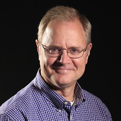
Kevin Selle
Wichita Falls, TX
Male, 55


I've been a broadcast meteorologist on television since the early 1990's. Happy to answer any questions about the weather or local TV news. Yes, I often wear sneakers on set just out of view of the camera.
Yup! Not too crazy. The rain has to start and stop someplace, why not over your house?! Thanks!
Share Answer: 

You bet. kselle@kfdx.com
Share Answer: 
For weather the primary tools are satellites, radar and computer forecast models that use weather balloon data and many types of other sensors.
Share Answer: 
I think I would do a search for rain gauge and buy one. It needs to be calibrated for the opening and bucket size. Have fun!
Share Answer: 
Radio program/music director
 Do radio stations have to pay royalties to artists to play their songs?
Air Traffic Controller
 When would you order fighter jets to be scrambled?
Magician
 What's the most amazing magic trick you've ever seen?
You could make that argument, Pamela. The amount of moisture in the air can be a function of the direction of the wind and a moisture source. Where I live, in Texas, for example, a southeast wind will bring moisture from the Gulf of Mexico and make it feel more humid. Thanks!
Share Answer: 
Hello, Mrs. Mills. Broadly speaking the leeward side of the Allegheny Mountains would be the eastern side, closer to the coast. At any given moment the windward side of anything is that facing the wind. In general terms the broad atmospheric flow is west to east across the United States. Here is a good definition on Wikipedia. Thanks. https://en.wikipedia.org/wiki/Windward_and_leeward
Share Answer: 
Great question, Richard! Each storm and location is a little different. Much of the precipitation type is determined above the surface of the earth. The snowflakes form thousands of feet above the ground and stay frozen as they fall. A very shallow layer of air at the surface could be above freezing but not deep enough to melt the snow.
Share Answer: 
-OR-
 Login with Facebook
 (max 20 characters - letters, numbers, and underscores only. Note that your username is private, and you have the option to choose an alias when asking questions or hosting a Q&A.)
(A valid e-mail address is required. Your e-mail will not be shared with anyone.)
(min 5 characters)
By checking this box, you acknowledge that you have read and agree to Jobstr.com’s Terms and Privacy Policy.
-OR-
Register with Facebook(Don't worry: you'll be able to choose an alias when asking questions or hosting a Q&A.)



 Browse Jobs
 Host a Q&A
 Search

 Submit Your Question
 Host a Q&A
 Last 7

