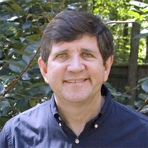
I've been a broadcast meteorologist on television since the early 1990's. Happy to answer any questions about the weather or local TV news. Yes, I often wear sneakers on set just out of view of the camera.
Interesting question. You might try here: https://weather.gc.ca
I started my career as a disc jockey on the radio. The weatherman at a local TV station and I became friends and he got me involved in a correspondence course in meteorology at Mississippi State University. I interned with him while taking the course and practiced being on TV. After completing that course I became the weekend meteorologist at my friend's station and have been doing it at several stations for about 25 years now. Thanks for asking!
Thanks for asking. Was always interested in clouds and the sky and when I began to study and learn how much was going on up there I just kept going. Take care!
Hmmm...not really my area of expertise. I'd say distance into the time zone and latitude/curvature of the earth must. Thx
Chick-fil-A General Manager
 What's the back-story behind the cow mascot and eat-mor-chikin campaign?
Debate Coach
 Are presidential debates actually "debates", by the traditional definition?
Obstetrician Gynecologist
 Has being an OBGYN affected your own beliefs about when "life" begins?
Hi, Drew. Usually a warmer water discussion is relevant for hurricanes. I would use these resources. Good luck! http://www.nhc.noaa.gov/ http://www.spc.noaa.gov/
Not too bad. There are always subtle differences in the day to day forecast if you care to go looking for them that don't show up on TV. Also, most TV folks do public appearances so we go different places. Good question, never had that one. Thanks!
Not aware of anything off the top of my head, Michael. Can you post the picture somewhere with a link, maybe Twitter or Flickr and I'd be happy to take a look. Provide as much information as you can, like where you were, what direction you were looking, time of day, etc. You might have some luck checking with a local science museum or astronomy club, or the nearest National Weather Service office. www.weather.gov
-OR-
 Login with Facebook
 (max 20 characters - letters, numbers, and underscores only. Note that your username is private, and you have the option to choose an alias when asking questions or hosting a Q&A.)
(A valid e-mail address is required. Your e-mail will not be shared with anyone.)
(min 5 characters)
By checking this box, you acknowledge that you have read and agree to Jobstr.com’s Terms and Privacy Policy.
-OR-
 Register with Facebook
(Don't worry: you'll be able to choose an alias when asking questions or hosting a Q&A.)